FOZ DO COBRÃO
N 39.73086º; W 7.76123º
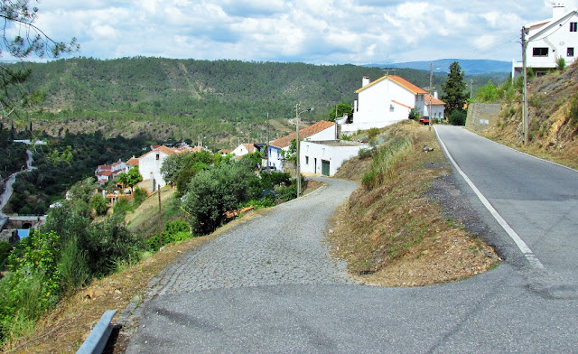
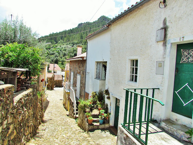
Foz do Cobrão is a village in the parish and municipality of Vila Velha de Ródão, in the district of Castelo Branco.
It is located at the foot of the western slope of Serra das Talhadas, on the left bank of the Ocreza River, in the extreme northwest of the municipality that borders the municipality of Proença-a-Nova.
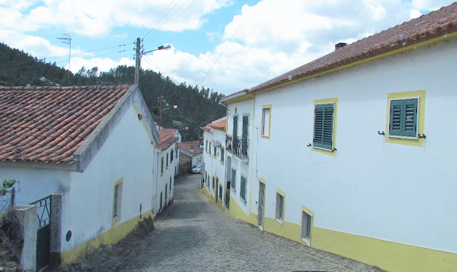
It was one of the villages that made up the Schist Village Network, and is currently no longer part of it, with Portas de Almourão, a geosite of the Meseta Meridional Naturtejo Geopark, also located nearby.
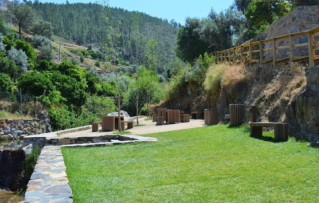
The Foz do Cobrão Leisure Area is located on the banks of the Cobrão river, in the Schist Village of Foz do Cobrão, municipality of Vila Velha de Ródão.
It is a pleasant place suitable for leisure activities, being frequented by hundreds of people during the summer period, particularly after being the target of a requalification and enhancement intervention in 2016.
The intervention area comprised a section of the river measuring approximately 120 meters in length, the main objectives of which were the stabilization of the banks and slope of the water line, desilting, cleaning and unblocking the riverbed at the most critical points and conservation of the soils of the river. marginal horticultural spaces. A river pool was created with its use in mind as a recreational space, but also to support irrigation or firefighting.
In 2021, in order to respond to the increase in tourist demand in the village and improve the comfort and safety conditions of visitors, the space was the subject of an intervention to provide support infrastructure (changing rooms, support bar with terrace, space for rescue equipment), a car park, accessibility for people with reduced mobility and green spaces.
Access to the leisure area is via steep and very narrow streets. There are very few places to park your car.
PORTAS DO ALMOURÃO - FOZ DO COBRÃO
Portas de Almourão is located between the Schist Village of Foz do Cobrão (Vila Velha de Ródão) and Sobral Fernando (Proença-a-Nova), corresponding to the gorge of the Ocreza river. It is a geological occurrence that results from the action of this river, whose waters ripped through the imposing quartzite cliffs, and a geosite classified in the Naturtejo Geopark, a place of breathtaking beauty.
This diverse geological landscape supports very well-preserved ecosystems, which are home to an important nesting area for birds of prey and other very important species such as, for example, the blue blackbird, the otter, the badger and the squirrel.
At this point, we come across a 400 meter deep gorge, which gives way to a valley with a wild and stunning landscape, where we feel small compared to the grandeur of Nature.
There is a constant presence of animal species with high protection status at the site, including the colony of griffon vultures that nest on the rocks that line the Ocreza river, the black stork, the eagle owl, the royal heron and the short-toed eagle, among other species. In the river it is possible to observe otters fishing and playing in its waters.
Walking the Foz do Cobrão Schist Path, one of the walking routes suggested by the Municipality of Vila Velha de Ródão, is one of the recommended ways to better understand the unique landscape that surrounds Portas de Almourão.
Characteristics
Free parking
With viewpoint
Address
Municipal Road 545 (Chão da Servas - Foz do Cobrão)
6030-163 Foz do Cobrão
The Geomonument of Portas de Almourão is an enchanted place where Ocreza gutted the quartzite cliffs that were intensely deformed with its erosive force over time. It is visible from the viewpoints of Foz do Cobrão and Sobral Fernando (thematic viewpoints). The Portas de Almourão correspond to an impressive gorge carved by the Ocreza River in the last two million years, which divides the Serra das Talhadas into two powerful quartzite ridges. Walking inside this 400 m deep gorge is like taking a trip back in time to almost 500 million years ago, to a time when hard quartzites were fine sands deposited at the bottom of a vast ocean. A continental mega-collision and 140 million years were needed to deform, to lift them from the seabed to the highest peaks of these mountains, more than 300 million years ago. 250 million years of chemical alteration of rocks and erosion shaped the Almourão region into the colossal landscape that we can enjoy today. In this place, the silence of the geological convulsions of yesteryear is only interrupted by the flight of the griffin. In addition to several viewpoints to observe this geomonument, the walking trails "Caminho do Xisto – Voo do Grifo", "Segredos de Vale de Almourão" and "Journey to the Bones of the Earth" are suggested.
TRAIL
Portas do Almourão Viewpoint - Little Reservoir of the Ocreza River
Sobreira Formosa, Castelo Branco District, Portugal.
Extension
4.2 km
Elevation gain
174 m
Route type
Round trip
Enjoy this 4.2-km day trip trail near Sobreira Formosa, Castelo Branco District. Generally considered a moderately challenging route, it takes an average of 1 hour 20 minutes to complete. This trail is great for hiking, and you probably won't meet many other people while exploring. The trail is open year-round and is beautiful to visit at any time.
Start your trail in the schist village called Sobral Fernando and follow the trails through the Serra das Talhadas in search of the Miradouro das Portas do Almourão.
This viewpoint, a geosite of the Naturtejo Geopark, allows a privileged observation of the scaling of the river terraces downstream of Portas de Almourão, between the bank of Sobral Fernando and the bank of Foz do Cobrão.
This is an observation point of the Ocreza valley, deeply carved into the Serra das Talhadas, with a difference in level of over 350 m.
Carefully descend to the small reservoir of the Ocreza River and marvel at the quality of its waters.
A very interesting little trail, however there are walking paths complete with official routes on the alltrails app if you want an adventure with more spices.










.JPG)


